From Cedar City, it is about 40 miles and 4,000 foot elevation gain to Cedar Breaks. Bryce Canyon is another 50 miles, primarily west and a slight elevation drop. Most writings see Bryce as the top of the Grand Staircase because it lies on the same Colorado Plateau as Zion and the Grand Canyon. Enough about that…Today’s post is about hoodoos.

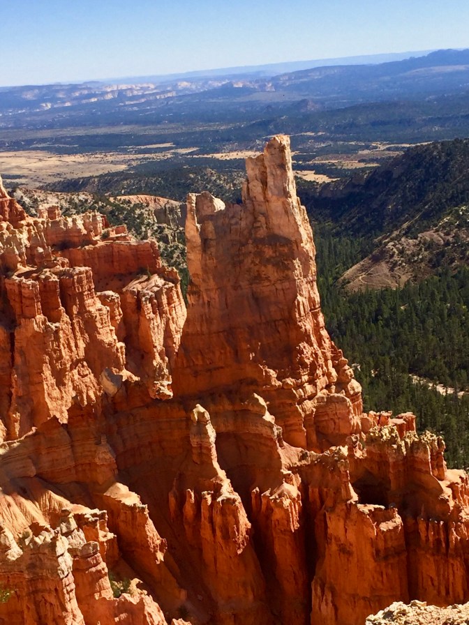
Once again, “hoodoo” is a Paiute word for a rock formation that, to them, mimicked human form. While hoodoos are found throughout the world, there is a higher concentration in Bryce Canyon than anywhere else. They are the result of a two-step erosion process… First, water combines with Carbon Dioxide to form a mild acid which eats away at the soft and porous limestone. Over great periods of time, since some took millions of years, the limestone on either side of harder rock dissolves. This process is assisted by the ice cracking that was discussed at Cedar Breaks… Water from precipitation finds its way into the rock seams, and as the temperature drops at night or during winter, the water turns to ice and expands, causing further erosion. What is left is a center spiral of harder, more resistant rock, which we are calling a hoodoo. Or maybe the Paiutes are right that they really are evil souls.


As we drove into Bryce, we entered Red Canyon. The oxidation process here created the reddest rock I have seen thus far. And the pic above shows the tunnel cut through the rock for our car. I wondered how this was treated to prevent the erosion discussed above.
In Bryce, as was the case at Cedar Breaks, roads took us to vista points at the crest of the canyon walls which let you look down at the hoodoos. There are a series of wonderful hiking trails, some that travel just below the rim, while others take hikers to the base. Unfortunately, these hikes became a non factor for us after Mrs Bear’s accident. If healthy, she would have hiked me into the ground daily. So we made our way along the rim and found sections of paved paths that let her wheel along some of the edges.


If you look at the middle photo above, the closest rock formation on the left is a hoodoo that is past its prime. Eventually, all these hoodoos will erode away, but maybe they will be replaced by a bunch more evil people who will die in the next million years!! Let’s all us healthy souls come back and check it all out…
Once again, we were blessed with a remarkable day… Temps in the 60s, blue skies, and little wind. All the better to appreciate what we were seeing.
