Our last days in New Zealand will be focused on activities based from the town of Queenstown, located on the banks of Lake Wakatipu. Today, we went to Milford Sound and cruised the fjord. But this post will focus on the incredible travel just to reach the Sound.
Lake Wakatipu is a glacier-carved, mountain-fed lake of more than 50 miles in length and 400+ feet in depth. It is similar to Texas, USA, lakes… very narrow width…really more like a river with aneurysms. Except in this case, Wakatipu has few headwaters. It empties into only one river, which we followed yesterday to arrive in this beautiful town, 1000 feet above sea level.


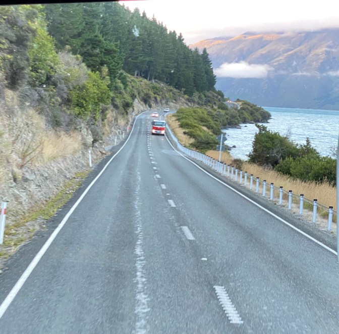
I’ll have more to say about Lake Wakatipu in future posts, but today, I reference it as the first part of our journey to reach Milford Sound. We drove the length of the lake along its edge. Looking past the lake, there was a continuous headland, which when seen together, reminded me of Loch Ness. So… we start out with new memories of New Zealand and remembrances of Scotland!!!


We next passed through a long valley, dotted with cattle, sheep, and deer farms…yes, deer farms. The English decided they wanted to hunt here, so they introduced lots of critters: Deer, Elk, Rabbit, Possum, etc. But like everything we do, these additions tended to screw up the ecosystems, primarily because there are no natural predators. But in the case of deer, the locals found a tremendous market for venison, selling primarily to Germany. So farmers fenced off pastures and domesticated part of the deer herd. It seemed to me that the deer could jump over the fencing we saw, so I asked about it. Our local guide agreed, but told us that the pasture grazing is so much better than the grass in the highlands, so the deer stay voluntarily.
A digression back to the ride along Wakatipu. Our guide told us it was called “ The Devil’s Staircase,” because a farmer lost a herd to a stampede when his Beasties ran off the edge and drowned in the lake water below. He told his wife that the Devil lured his cows to their deaths, and the name stuck.


We eventually came to another beautiful lake and town, that let us stop for bathrooms, drinks, and food. Instead of eating, I ambled back to the lake to take a pic of this helicopter that landed on a wharf.


Then, it was through another beautiful valley with steep rock walls on both sides. This was called the Ellington Valley. I was so mesmerized by the sheer brilliance of this combination of flat valley floor and sheer walls that our driver had to come get me to continue on.


We stopped a few miles down the road as the valley ended, replaced by a few small ponds in the shadow of the mountain wall. This resulted in the MIRROR pics you see above!! Incredible!! And these were just the opening acts!!
Soon after, we reached the designated spot for our convoy. This is not the normal set-up. But about ten days ago, the road over the mountains into Milton Sound received 38 inches of rain in three days! While this area is in a rain forest and averages 100” of rain per year, this Super-RainBomb flooded out parts of the road and put the visitors center out of commission. The road reopened two days earlier, and incoming traffic was limited to mass transportation and led through the passes in convoys. This allowed the repair units to maximize their efforts with minimal interference by traffic.


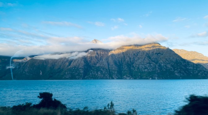
The map of the road through the Fjords National Park is at the top of this post. It rises gently to 3000 feet above sea level, with stone walls on both sides that tower thousands of feet higher. During the winter, this is a major avalanche zone, and it was easy to see how all that rain rain down the sides of these granite walls to wash out the road. The above pics, and those that follow, were taken through the window of the bus. There was no stopping while in the convoy.
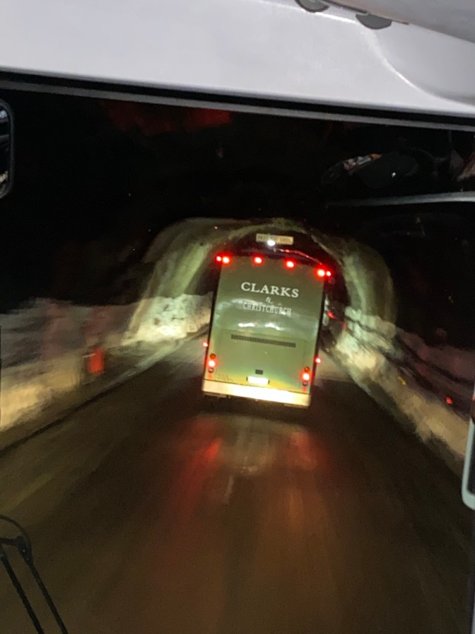
At three thousand feet up, the river started flowing the other direction toward the sea (they call it the Divide), and we entered a very crude, no frills tunnel. Our driver said that the convoy saved us about ten minutes…Vehicles usually have to wait as one-way traffic passes through.


Now, it was a ten mile drive that took us back down to sea level and the beginning of the fjord. In retrospect, I thought this narrow ravine with towering stone walls closing in on both sides reminded me of the geology of the Sound… same rock and narrow passage, but no water. I asked our guide about this on the way back out, and he said I was right on. It seems that the glaciers during the last ice age had pushed up this elevation before receding. The result was a truly spectacular ride and cruise through a glacial valley and fjord. I hope you liked the description of the road/land passage…An account of Milton Sound is next.

Great post 😁
Thanks