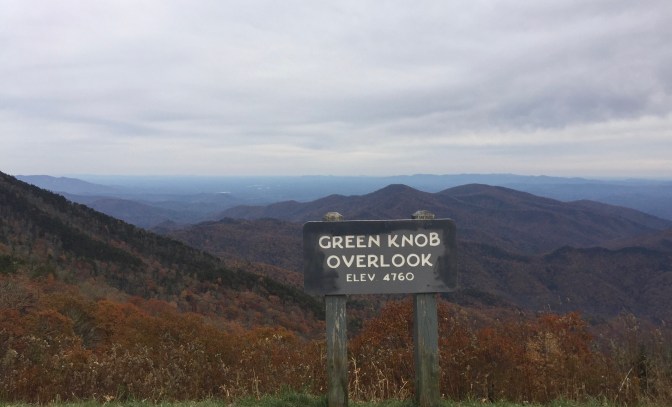
Before today, I didn’t think that any stretch of road could possibly be more beautiful than the Big Sur Highway. But then we began our drive up the Blue Ridge Parkway. A little background before the pics are presented… The Blue Ridge Parkway is a 470 mile consummate back road that connects the Smokey Mountain National Park in North Carolinia with Shenandoah National Park in Virginia. It is a linear, north-south road that is statistically the most visited National Park road almost every year. The Parkway’s construction began as part of FDR’s New Deal in the 1930s. Acquisition of private and Cherokee land delayed completion until the 1960s, with the exception of a seven mile extension around Grandfather Mountain that wasn’t completed until the 1980s. The road was and is meant to be a slow, pleasurable ride up the spine of the Blue Mountains. It has few entrances, especially in the south, and no trucks are allowed. The most prominent features, other than views, are scenic turnouts, which are all named and marked. Occasionally, we saw local state roads that paralleled the Parkway… But rarely were they ever connected. This road was constructed in a manner that excludes local traffic use. Homes that border the Parkway have to be approached by outside roads… You will never see a home with a driveway on the Parkway. As I said earlier, the Blue Ridge Parkway is America’s Back Road.


And now, some pictures to back up my claim that the Blue Ridge Parkway is America’s most beautiful drive… We began within 50 miles of the southern entrance, and were immediately confused. While following the sign to head north toward Asheville, NC, the road took us primarily south for the first 15 miles before finally veering west, and then north. There were few exits and a sign said there was no gasoline available for the next 50 miles. I have to admit that I thought I’d either confused the direction, or that someone turned the signs around. What really happened is that the road tightropes along the very top spine of the mountain ridges, and thus had to follow the topography of the formations. But the result is a road that maintains an elevation near 5,000 feet and looks out on layers of mountains. Often, the scenic turnouts alternated between looking east, then west. It didn’t really seem to matter.

The Parkway south of Asheville, North Carolina, is the most scenic. Our first day ended at Blowing Rock. We scheduled three days to drive the 400+ miles, ending in Charlottesville, Virginia… Nothing too quick for this road

One final note about driving the Parkway in November. So far, we had nice days with temps in the 50-60 range, and very little traffic. Most of the time, it seemed that we had the road to ourself. On the other hand, services are limited by closed restaurants and inns. We had to make an exit with a 30 mile detour for a bathroom at a gas station / market. On the other hand, the local roads are almost as nice as the Parkway. Our detour took us down off the high elevation spine to the valley below. And our road to get back winded back up the switchbacks to the ridge line. So, we have learned to monitor our liquid intake on this Road of Roads. More to come…

